Today Falkor visited Vulcan Shoal, the second of four submerged or ‘hidden’ reefs that will be surveyed during the cruise. This oval shaped shoal 7km in length and 3km wide, rises steeply from depths of around 180 meters and has a relatively flat plateau at the top around 24 meters.
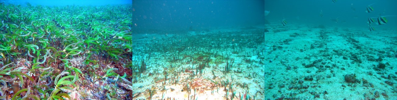
What the seagrass beds of Vulcan shoal look like today. Images from 22/04/2015 showing no obvious recovery of the seagrass habitats (black lines on the seafloor are remnant rhizophore root network from seagrass beds.SOI
At Vulcan Shoal, the research team is particularly interested in examining how these hidden reefs change through time and how physical disturbances such as storms and cyclones can affect the reef communities. This shoal has previously been surveyed by the Australian Institute of Marine Science (AIMS) in 2010, 2011, and 2012. The intensive sampling was triggered in response to an explosion at the Montara well head located 40km to the north east. The explosion occurred on the 21st of August in 2009 resulting in a 74 day spill of oil and gas into the Timor Sea. The post-spill surveys reveals some dramatic changes in the benthic community. For example, in 2010 Vulcan Shoal was found to support very dense and extensive seagrass meadows. However, in 2011 all the leaves on the seagrass were gone with just a field of rhizomes remaining. In the most recent survey in 2013, the seagrass meadow showed no signs of recovery. This highly significant change in seagrass cover may reflect a natural disturbance or a differential effect of the uncontrolled release, as the corals seemed healthy and slightly more abundant.
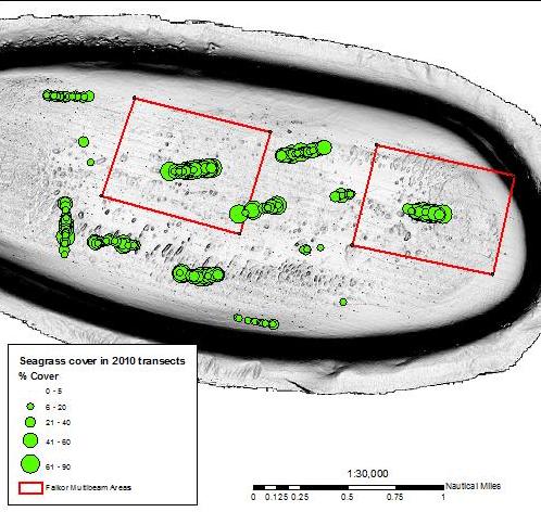
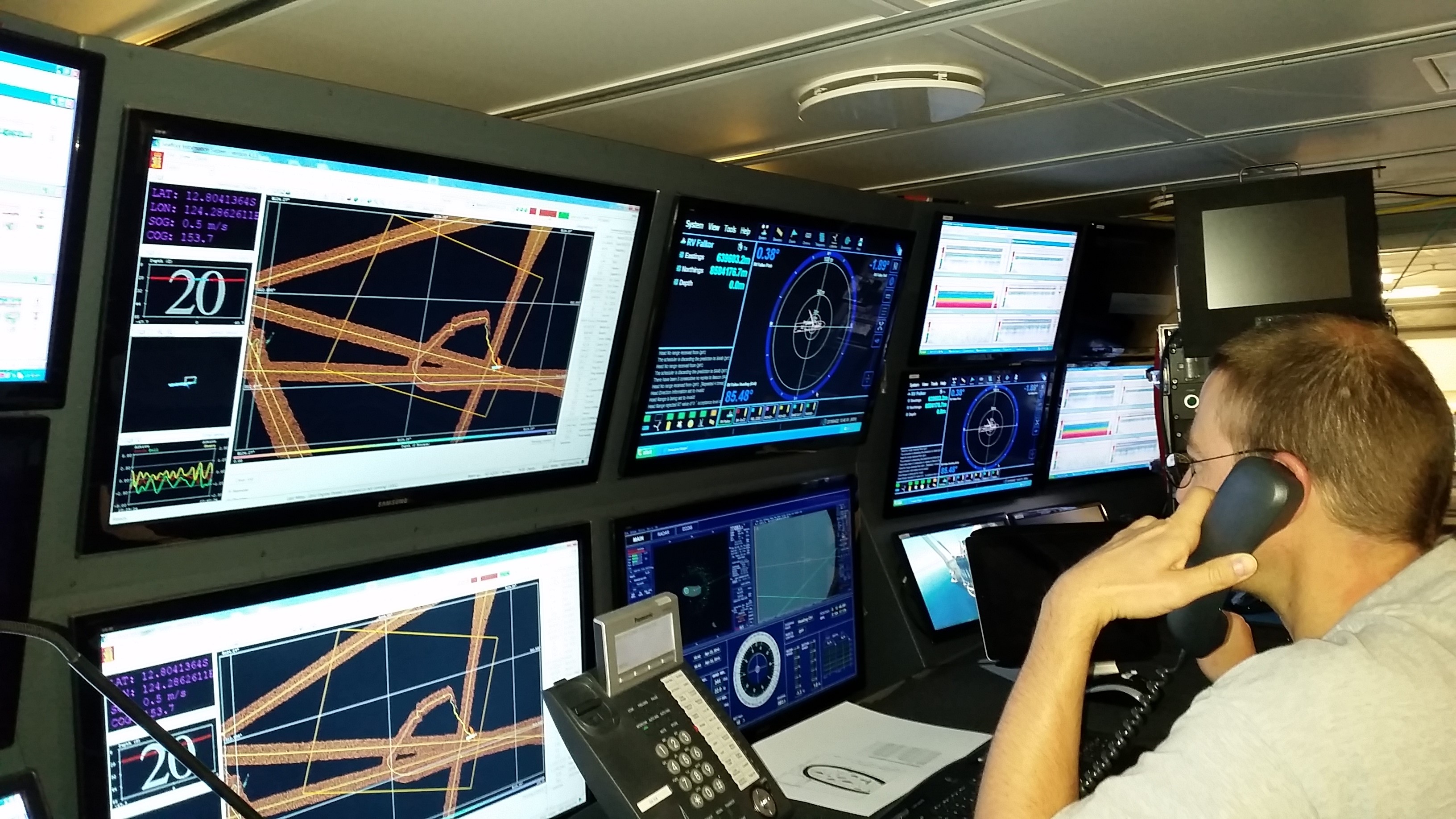
Falkor is equipped with a Kongsberg EM710 multibeam system. The EM710 can generate a high resolution 3D map of Vulcan Shoal by measuring echoes from the sea floor created by sound pulses the multibeam generates. By comparing the survey today to previous surveys we will be able to calculate where, and by how much, the seafloor has been disturbed.
Physical disturbance and seagrass loss
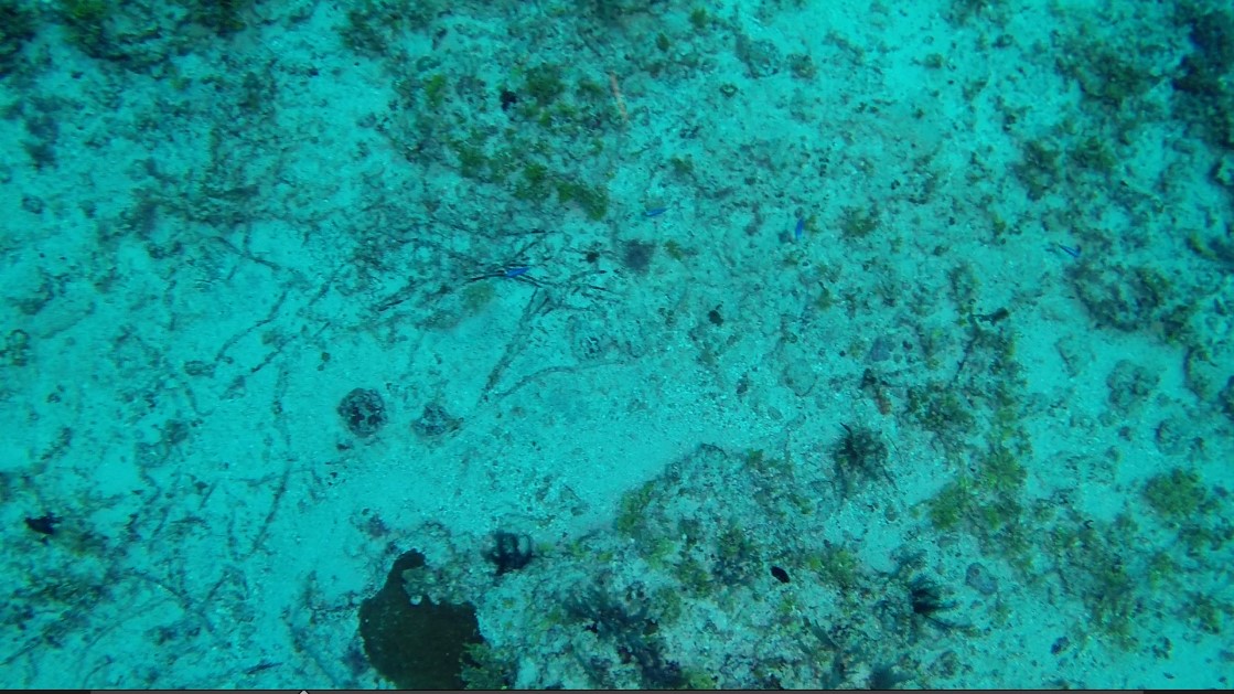
Data collected during this cruise is increasing our understanding of how physical hydrodynamic disturbance could play a major role in shaping benthic communities on shoals such as Vulcan Shoal. The seagrass loss since 2010 is mostly physical in nature affecting loosely attached biota. A storm or other source of strong seabed shear can scour away the seagrass and other loosely attached organism present on rubble and gravel substrate. An analysis of images from the same locations between the three time periods, including the work today (see image below) suggest a physical scouring event. Not just seagrass cover has changed in abundance, but other loosely attached benthic organisms such as Halimeda algae and ascidians are also markedly reduced.
A variety of other factors can cause rapid change in the seagrass including a possible urchin predation from an out-break or thermal stress due to abnormal sea water temperature events. Analysis of 2010 and 2011 images found no evidence for large populations of urchins on Vulcan Shoal. A potential role of seawater temperature cannot be excluded. Analysis of blended satellite sea surface temperature data does reveal a rapid change from unusually warm conditions in 2010 to unusually cool conditions in 2011. The cause of the seagrass loss at Vulcan Shoal cannot be definitively determined, however, the evidence collected increasing points towards hydrodynamic disturbance from storms.