Even in this modern age, the world below the waves remains mostly unexplored. We routinely hear about scientists discovering new species in all depths of the oceans, yet it can easily be overlooked that many of these study locations have names more precise than the broad title of Ocean.
Thousands of geographic features under the sea have been given names over the centuries. Some of these are well known: Challenger Deep, Mid-Atlantic Ridge, Galapagos Rift and Iceland Basin are just a few. These locations can be huge, spanning many thousands of square miles such as the Mid-Atlantic Ridge and East Pacific Rise. If these features were located on land, they would certainly attract tourists, but deep in the inky blackness of the ocean, the majority of these features remain hidden away. Names aren’t exclusively used for large features and may be applied to areas that are geographically very small and would represent little more than a hill on land. Even relatively slight features such as hydrothermal vents have gained official names that appear in science papers and documents.
Original publication: Royal Geographical Society (RGS)
Naming these features, especially those near the surface, is useful for safe navigation, fishing, and maritime jurisdiction. Those features named in the deeper ocean help scientists define study locations that can be referred to by name in publications. The principal concern in naming is to provide effective, convenient, and appropriate reference.
A new name appropriate for explorers
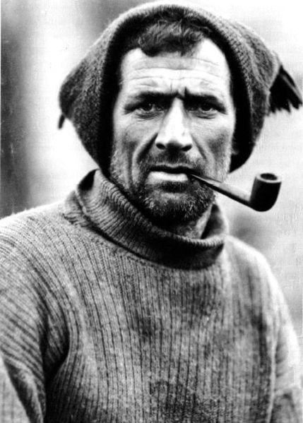
As a marine technican, I am interested in all kinds of exploration, but especially polar explorers – and one of the most capable pioneers in the heroic age of polar exploration was named Tom Crean. Crean first sailed to Antarctica from Lyttelton, New Zealand on RRS Discovery. He ultimately made three trips to Antarctica with Captain Robert Falcon Scott and Ernest Shackleton, and was awarded three polar medals as well as the Albert Medal. His exploits and achievements, most notably the journey he made from Antarctica to South Georgia in an open boat, made him one of the most remarkable characters to have set foot on that frozen continent. Tom Crean was a modest man, and when he returned to his native Ireland, he put all of his medals away and never again spoke about his experiences in the Antarctic.
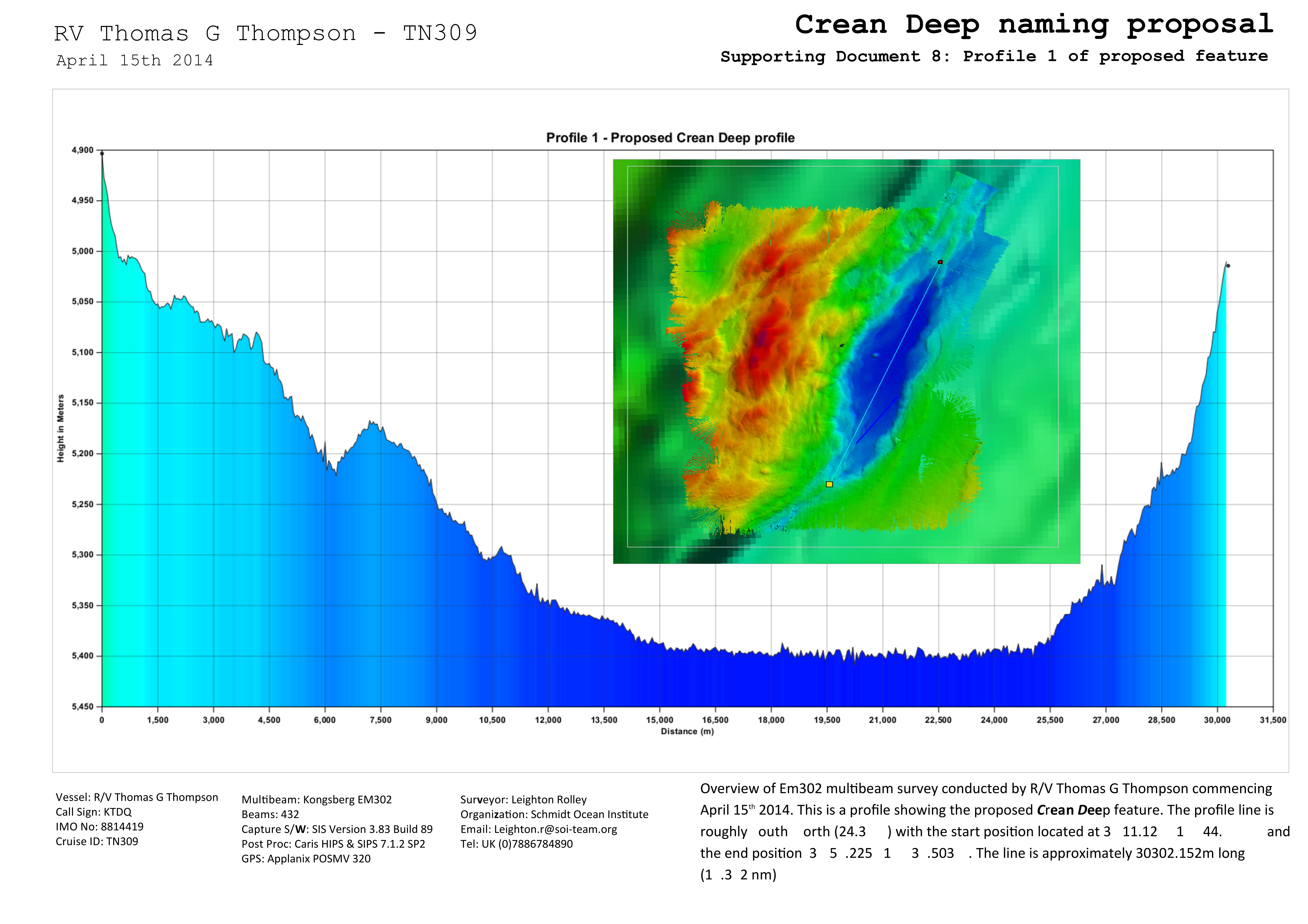
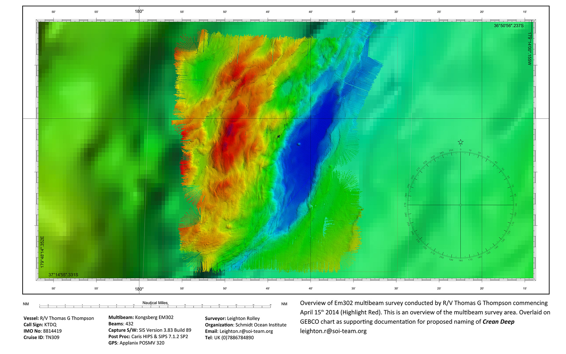
In 2014, while I was waiting to join a research cruise in New Zealand, I had the chance to visit Lyttelton (which still acts as a base for polar exploration vessels) and purchased a book about Tom Crean. During the expedition a new feature was found at 600m that was roughly 29km x 8km – this would be a big feature if it was above water. Its depth ran down from 4800m to 5400m.
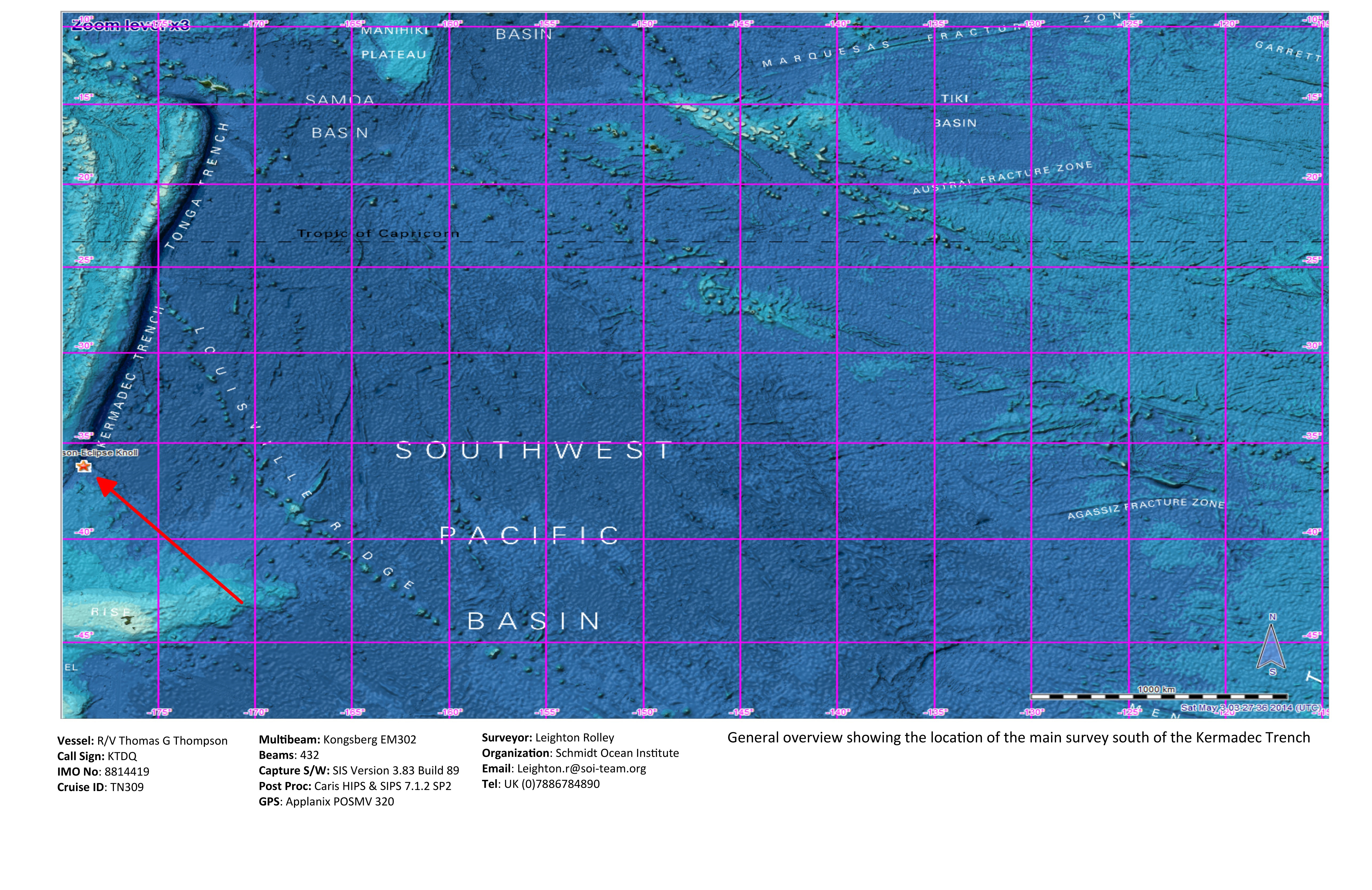
Recently, I was successful in my application to name this new feature located at the start of the Kermadec Trench, one of the deepest trenches on the planet. And of course, who but Tom Crean was at the forefront of my mind when we found this new feature. Naturallly, I put forth “Crean Deep” for the feature’s new name. This was the first time I have ever named a feature, so it was a very steep learning curve. There is a process and a good deal of standards written for the naming of subsea features. The International Hydrographic Organization and the Intergovernmental Oceanographic Commission are two of the organizations that work with nations around the world to standardize undersea names.
Before you name something, you first need to find it
Schmidt Ocean Institute’s ship R/V Falkor is equipped with a multibeam system that can map down to 10,000m with a high level of accuracy – this is important when you are submitting a name proposal. During the course of an expedition we may detect a feature on our multibeam sonar that isn’t named or hasn’t be found before. Prior to the naming of a feature, its character, extent, and position should be established sufficiently for identification. So we have to plan a multibeam survey that defines the size and shape of the feature. One pass with theFalkor’s multibeam is not enough and it is good practice to run multiple survey lines over the feature to ensure good coverage and data quality.
Once we have mapped the feature with Falkor’s multibeam we then process and clean the data using specialist software – this is known as post processing. With this software we can produce contour maps of the feature and accurate charts with latitude and longitude. We can also produce three-dimensional imagery, videos and profiles to show elevations of the feature.
What type of feature
After high-quality charts of the feature are produced, we then need to define exactly what type of feature has been discovered. If, for example, we found a 1400m high “mountain” on the seabed, is it a Hill, Knoll, Mound, Seamount or Guyot? Once the exact type of feature is identified (there are currently around 50 definitions), we can then move on to the exciting stage of choosing the name. First, let’s explore in a little bit more depth what each of these feature types are:
Seamount – A distinct generally equidimensional elevation greater than 1000m above the surrounding relief as measured from the deepest isobath that surrounds most of the feature
Hill – A distinct elevation generally of irregular shape, less than 1000m above the surrounding relief as measured from the deepest isobath that surrounds most of the feature.
Knoll – A distinct elevation with a rounded profile less than 1000m above the surrounding relief as measured from the deepest isobath that surrounds most of the feature
Mound – A distinct elevation with a rounded profile generally less than 500m above the surrounding relief as measured from the deepest isobath that surrounds most of the feature, commonly formed by the expulsion of fluids or by coral reef development, sedimentation and (bio)erosion.
Guyot – A seamount with a comparatively smooth flat top.
Naming the feature
There are rules for naming the features as well as the application of common sense – just because we found the feature doesn’t mean we can call it “Kangaroo high fiving a llama shaped seamount.” Short and simple specific terms are preferable. The principal concern in naming is to provide effective, conveniently usable, and appropriate reference; commemoration of persons or ships is a secondary consideration. The first choice of a specific term, where feasible, should be one associated with a geographical feature; e.g.: Aleutian Ridge, Mariana Trench, Barrow Canyon. Other choices can commemorate ships or other vehicles, expeditions, or scientific institutes involved in the discovering and/or delineation of the feature, or to honour the memory of famous persons. Where a ship name is used, it should be that of the discovering ship, for example “Falkor.” I’m often asked if you can name a feature after yourself, but names of living persons will normally not be accepted. In the rare cases where names of living persons are used (surnames are preferable), they will be limited to those who have made an outstanding or fundamental contribution to ocean sciences.
Paperwork is available from the IHO for entering the details of the discovery. Reasons for choosing the name and the type of feature also must be supplied. Specific details such as maximum depth, dimension/shape, total relief are also required. Exact coordinates defining the features are also needed so its location can be identified on a chart. Supporting survey data from the ship is needed and detailed information on the mapping systems used. The paperwork is extensive. Once completed, the paperwork is sent to either the IHO or directly to the country who is responsible for the water in which the feature is located. The name and supporting data is then studied and reviewed to determine if the proposed name is acceptable. Once accepted, the name begins to appear on charts.
There is a great sense of pride in getting to name a feature, especially after a personal hero. It is a strange feeling to know that this place and its name will be around long after I’m gone!