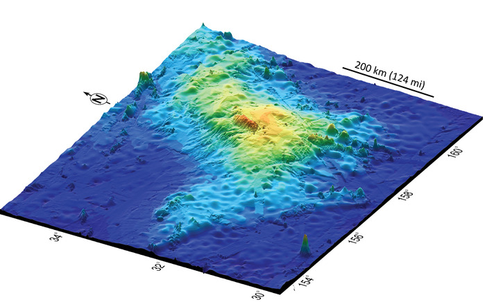
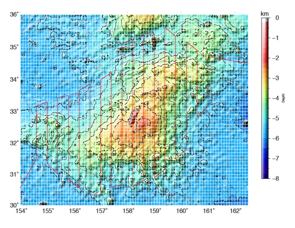
In 2013, research published by chief scientist Dr. William Sager, showed Tamu Massif to be the largest mountain in the Shatsky Rise oceanic plateau and the world’s largest single volcano. Dr. Sager and his team were able to come to this conclusion through the drilling of core samples and seismic imaging of the interior. Scientists concluded that the underwater volcano, located approximately1500 km east of Japan, was formed from massive, fluid lava flows traveling long distances. The fluid lavas are believed to have caused the volcano to be very wide (>500 km) with low flank slopes, different from the common volcanic seamounts that are scattered across the ocean basins. The claim that Tamu Massif is the “world’s largest single volcano” garnered widespread public interest in this finding and left people wondering how something this big could remain so mysterious in the 21st century? This disconnect highlights the fact that the oceans are still poorly explored, especially in the middle of the deep ocean.
The Expedition
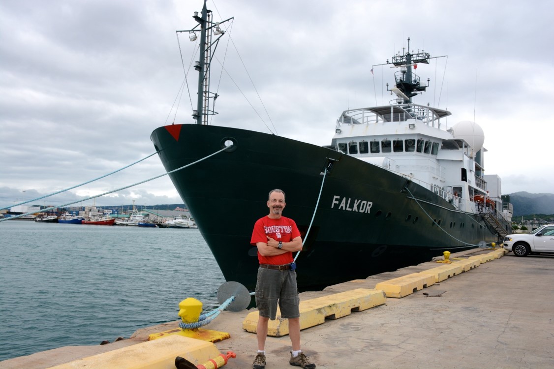
Dr. Sager and his team are now returning to the very spot of the discovery, and will spend the next 36 days aboard Schmidt Ocean Institute’s R/V Falkor collecting magnetic data in order to understand how Tamu Massif was formed. The science party will also use bathymetry (depth) data because only about 20% of the volcano has been covered by existing data. The rationale for the magnetic data collection is that Shatsky Rise displays magnetic anomalies within the plateau. These stripes indicate laterally-constrained volcanism similar to mid-ocean spreading ridges, but unlike previous postulations for Tamu Massif. Indeed, from older data it appears that the northeast end of Tamu Massif has stripes, but the southwest part does not. So, does this indicate a fundamental change of the style of volcanism from one side to the other? This is a question that the team hopes to answer through data collection on this expedition.
Tamu Massif Blog
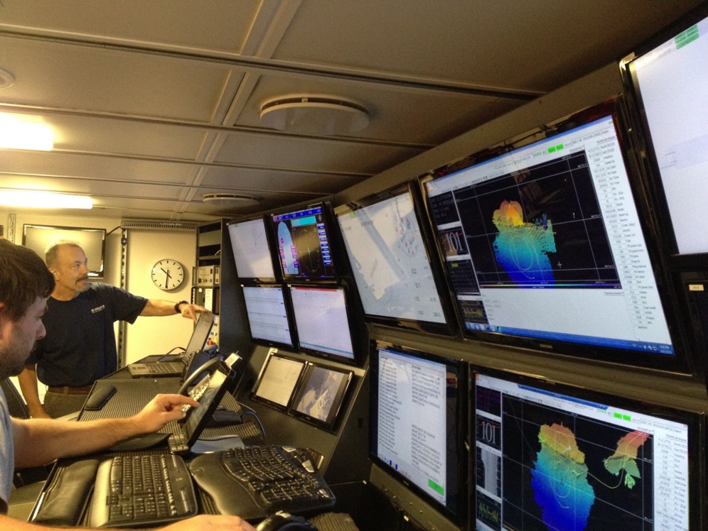
This blog serves as our connection to you. As professional scientists, students, and educators we want to share what science at sea is like on a daily basis and what doing marine geophysics research is all about. This expedition is an exciting opportunity for all us of to experience operating state-of-the-art instruments and gathering and processing important data. We hope you will come and experience the science, ship life, and community aspect of our journey as we explore Tamu Massif. Stay tuned as we share more about who we are, science discovery, ship life, and the connections we will be making with students following the cruise all over the world.